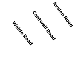
16 CANTWELL RD
Owner Information
MURPHY KATHRYN MARY
16 CANTWELL RD
MILTON, MA 02186


Property Details
16 CANTWELL RD is classified as a Single Family Residential (Colonial).
The primary structure on this property was built in 1963. There are 1,291ft2 of built area within this property. There is 1,291ft2 of residential/living space within this property. This property is listed as having 6 rooms.
16 CANTWELL RD is valued at $709,500. The land is valued at $414,900 and the structures are valued at $294,600.
This property is in Zone RC. Confirm with local Zoning Board authorities to ensure there are no overlays or other easements on this property.
The most recent deed for 16 CANTWELL RD is recorded at the local registrar in Book 33269, Page 550. 16 CANTWELL RD was last sold on Tuesday, June 30, 2015 for $625,000.
Assessment data from fiscal year 2021.
Flood Data
According to the FEMA National Flood Hazard Layer, this property does not appear to be in a flood zone. It may also be in an area not yet reviewed. Nonetheless, confirm this information prior to taking any action.
To view the flood hazards around this property, create a FEMA "Firmette" Map of the area around 16 CANTWELL RD.
Broadband Internet Providers
| Provider | Type | Bandwidth (mbps) | |
|---|---|---|---|
| RCN | Cable | 500 | 20 |
| VSAT Systems, LLC. | Satellite | 2 | 1 |
| Crown Castle Fiber | Fiber | 0 | 0 |
| Comcast | Cable | 1000 | 35 |
| Verizon New England Inc. | DSL | 15 | 1 |
| Viasat Inc | Satellite | 100 | 3 |
| HughesNet | Satellite | 25 | 3 |
| GCI Communication Corp. | Satellite | 0 | 0 |
| RCN | Cable | 1000 | 20 |
Broadband service provider data from December 2020.
Adjacent Properties
- 54 COLUMBINE RD
Single Family Residential owned by COLUCCI MARC & LISA BELDEN - 34 WALDO RD
Single Family Residential owned by FOURNIER REALTY TRUST - 14 CANTWELL RD
Single Family Residential owned by DSIDA MICHAEL & TERRI M - 15 CANTWELL RD
Single Family Residential owned by MURPHY MATTHEW - 60 COLUMBINE RD
Single Family Residential owned by ZUCKER ADAM J